
Pont des Amours, Annecy: A Visitor's Guide to the Love Bridge
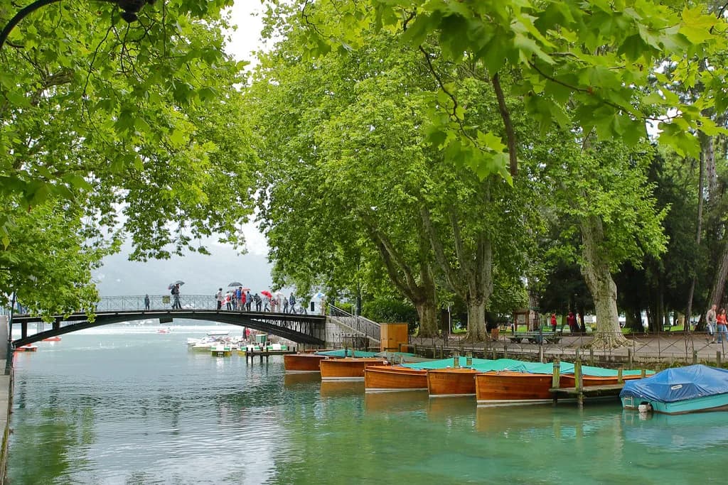
The Pont des Amours is a small pedestrian footbridge in Annecy that links Le Pâquier with the Jardins de l'Europe, and it takes about five minutes to see. Its appeal is the double view: the canal du Vassé and its small boats on one side, the lake and Mont Veyrier on the other. Treat it as a stop on a lakeside walk rather than a destination in its own right, and it slots neatly into a short break.
Officially the Passerelle du Jardin public, the bridge has long been known locally as the Pont des Amours, and that is the name you will see on maps and signposts. There is no ticket and no gate, so timing is about light and crowds rather than opening hours. The bridge sits where the old town, the park and the water meet, which makes it one of the easiest sights to fold into any walk through the centre.
What the Pont des Amours Is
It is a footbridge, not a road bridge, crossing the canal du Vassé where the water leaves the lake. One end lands at Le Pâquier, the broad open esplanade on the lakefront, and the other at the Jardins de l'Europe, the formal garden that runs along the canal. Its official name is the Passerelle du Jardin public, which is worth knowing when you look for it on signage.
Because it is a public crossing rather than a ticketed attraction, there is nothing to book and no opening time to plan around. You walk over it as part of a route along the water, pause for the view, and carry on. That is the honest trade-off: the bridge rewards a few minutes, not an afternoon.
Where It Sits in Annecy
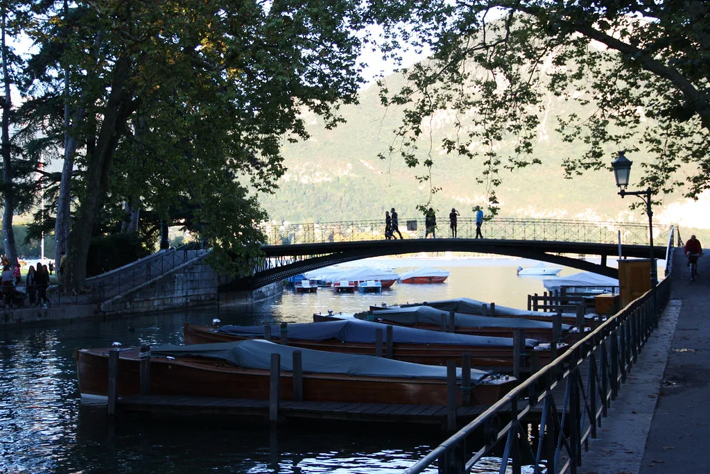
The bridge sits at the point where the canal du Vassé meets the lake, with Le Pâquier on the lakefront side and the Jardins de l'Europe on the canal side. Look one way and you get the canal, its small boats and the garden edges; look the other and you get open water with Mont Veyrier rising behind it. That contrast in a single crossing is the reason people stop.
In city terms, this is the seam between the Vieille Ville and the lakefront. The old town's canals and arcaded streets lie a short walk inland, and the park and waterfront spread out from the bridge. Knowing that geography lets you plan a loop that takes in the bridge without doubling back.
How to Reach It on Foot
From the old town, walk towards the lake and aim for Le Pâquier, the wide esplanade between the canals and the water; the bridge is at its far end where the canal du Vassé enters the lake. From the lakeside paths, follow the waterfront until the Jardins de l'Europe and the bridge appear. Both approaches are level and signposted, and neither needs transport.
Annecy's centre is compact, so the bridge works as a waypoint between the Palais de l'Isle and the waterfront rather than a separate excursion. If you are plotting a half-day walk, put the bridge in the middle and let the old town and the gardens fill either side.
What You Actually See from the Bridge
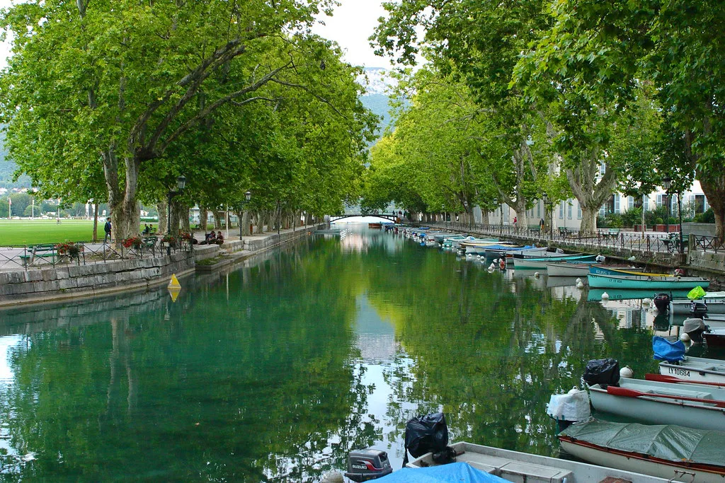
On the canal side, the view runs up the canal du Vassé past the gardens, with small boats moored along the banks. On the lake side, the water opens out towards Mont Veyrier, the ridge that closes the view to the east. Both views are best from the middle of the span, so step aside rather than stopping at the first railing.
This is a short-view sight: nothing here needs an hour of contemplation. What it gives you is a clean orientation point, showing how the canal, the garden and the lake fit together before you walk on. Photographers will find the canal-side framing tighter and the lake-side view more open.
The Name: Passerelle du Jardin public
Officially the bridge is the Passerelle du Jardin public, a functional name referring to the public garden it serves. The Annéciens renamed it the Pont des Amours long ago, and the affectionate name stuck. Expect to see both on maps, leaflets and street signage, and do not assume they are two different bridges.
The story behind the name is local folklore rather than documented fact, so treat any elaborate version you hear with a pinch of salt. What matters practically is the naming: search for either version when planning your route.
Love Locks and the Railings
Visitors attach love locks to the bridge railings, and the metalwork along the span carries a dense collection of them. It is a small ritual rather than an organised attraction, and it is the main reason some people linger longer than the view alone would justify. Bring your own lock if the tradition appeals, or simply read the names already there.
The downside is crowding: the bridge is narrow, and clusters of people at the railings slow the crossing at busy times. Cross early or late in the day if you want the span closer to yourself, and remember it is a working pedestrian route for people walking between the park and the lakefront.
How Long to Allow and When to Come
Budget five to ten minutes on the bridge itself, plus whatever time you spend in the gardens or along Le Pâquier. The bridge is a pause, not a visit, and the walks on either side are what fill a morning. That is why it pairs so well with a lakeside stroll rather than a dedicated trip.
For light, the canal side faces the gardens and the lake side opens east towards Mont Veyrier, so early light flatters the water view and later light softens the canal. Summer evenings bring the biggest crowds at the railings. There are no published opening hours to work around because the crossing is always open.
Access Notes for the Bridge
The bridge is steep, so wheelchair users will need someone with them to help with the crossing. The approach on the Le Pâquier side and the span itself are the parts to plan for. Anyone with limited mobility should weigh the crossing against the gentler lakeside paths on either side.
If the gradient is a problem, the views from the Jardins de l'Europe and the Le Pâquier waterfront give much of the same scenery without the climb. It is a reasonable substitute rather than an identical one, since the middle-of-the-span angle is what makes the bridge.
Nearby: Le Pâquier and the Jardins de l'Europe
Le Pâquier is the wide lawn and promenade on the lakefront, good for an open view back towards the water and the mountains. The Jardins de l'Europe on the other bank are formal, shaded and quieter, with paths along the canal. Together they turn a bridge crossing into a twenty-minute wander.
Beyond the gardens, the lakeside path continues along the shore for an easy flat walk, and the old town's canal quarter is a few minutes inland. The bridge makes a natural hinge between the two, so use it to switch from water to streets rather than retracing your steps.
Nearby: The Canals of the Old Town
The Vieille Ville's canals, the Palais de l'Isle sitting mid-stream and the arcaded lanes are a short walk from the bridge. The Palais de l'Isle, a former prison on its island, is the most photographed building in the city and a sensible next stop after the lakefront. Allow the old town an hour or two rather than rushing it.
Slightly further out, the Château d'Annecy on its hill gives the wide view over the rooftops that the bridge cannot, and the cathedral and the Basilica of the Visitation round out a full day's walking. Pick two of these rather than all four if you only have an afternoon.
Eating Near the Bridge
The bridge is best used as a stop on a walk rather than a lunch destination in itself; the eating places cluster in the old town and along the lakefront promenades. Cross the bridge, walk ten minutes into the Vieille Ville and pick from the streets around the canals. That keeps the bridge as a pause and puts the meal where the choice is.
If you want to eat with a water view, the Le Pâquier and lakeside edges are the obvious direction, though these are the busiest spots in summer. Book ahead for dinner and treat lunch as the flexible meal. Either way, the bridge is a five-minute detour on the way, not a reason to choose a restaurant.
Plan Your Visit
The Pont des Amours earns its place as a short, free pause between the old town and the lake, with the canal du Vassé on one side and Mont Veyrier across the water on the other. Give it five to ten minutes, cross it as part of a lakeside walk and let Le Pâquier and the Jardins de l'Europe fill the rest of the hour.
Anyone with mobility needs should plan for the steep span, and everyone should expect company at the railings in high season. Pair the crossing with the old town canals or the palace on its island, and the bridge becomes a sensible hinge in a day rather than a destination on its own.
Explore more Annecy guides
Frequently Asked Questions
Where is the Pont des Amours in Annecy?
The bridge links Le Pâquier, the lakefront esplanade, with the Jardins de l'Europe, where the canal du Vassé meets the lake. Walk towards the water from the old town and you will reach Le Pâquier in a few minutes.
What is the Pont des Amours called officially?
Its official name is the Passerelle du Jardin public. Locals renamed it the Pont des Amours long ago, and both names appear on maps and signage.
What can you see from the Pont des Amours?
The canal du Vassé and its small boats on one side, and the lake with Mont Veyrier behind it on the other. The middle of the span gives the best of both views.
How long do you need at the Pont des Amours?
Allow five to ten minutes on the bridge itself, plus whatever time you spend in the gardens or along the waterfront. The bridge is a pause rather than a full visit.
Is the Pont des Amours accessible?
The bridge is steep, so wheelchair users need someone with them to help with the crossing. The lakeside paths and gardens on either side are gentler alternatives.
What is near the Pont des Amours?
Le Pâquier and the Jardins de l'Europe are at either end, and the old town canals with the Palais de l'Isle are a short walk inland. The lakeside path continues along the shore.