
Ponts Couverts, Strasbourg: A Visitor's Guide to the Covered Bridges
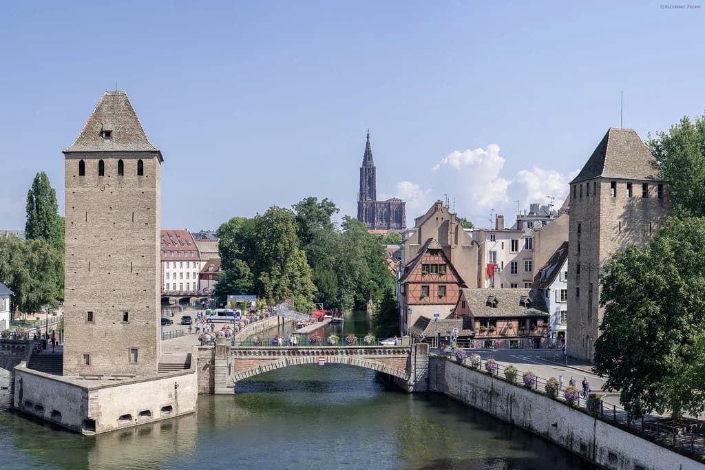
The Ponts Couverts are a free, open-air crossing in Strasbourg's Petite France, where a chain of bridges spans the Ill beside stubby stone towers. Treat them as a 15- to 20-minute stop folded into a wander through the quarter rather than a sight that fills an afternoon. The name promises roofs, but the ones you see today are bare stone.
They suit anyone already exploring the historic centre on foot, and they matter most if you want the tower-and-water view that defines so many Strasbourg photographs. If you are building a wider weekend, this sits naturally among the Strasbourg Attractions as a quick scenic pause between bigger sights.
What the Ponts Couverts actually are
A group of medieval bridges and fortified towers on the River Ill, holding a row of three bridges and four towers in popular descriptions. The bridges carry a pedestrian crossing; the towers stand in the water like a defensive line that never quite left.
They sit in the picturesque Petite France district, spanning the canal of the Ill and flanked by hefty stone towers. That position explains their appeal: you get water, old masonry and a tight, photogenic corner of the old town in one glance.
Where to find them and how to walk there
The Ponts Couverts stand in Petite France on the eastern side of Strasbourg's historic centre, and the easiest approach is simply to walk west from the cathedral quarter until the Ill opens out. As you cross into the quarter, look for the line of towers reflected in the water rather than a formal entrance.
From Strasbourg's station, the walk heads into the centre and on to the quarter, and the hotel opposite the station markets itself on exactly that quick access to the historic core. Allow a little more time than a straight map line suggests, because the lanes around Petite France reward a slow, winding approach.
The medieval origin: guarding river traffic
The crossing was built to protect the city's river traffic, with a defensive role at its core rather than a decorative one. Timber pilings were progressively replaced by stone, and portcullis-style defences were added to strengthen the position as weapons improved.
Dating is best left broad: the structure belongs to the medieval period, sometime around the 13th to 14th century depending on how the origin is counted. If a precise year matters to you, check a city heritage source before quoting one.
Why 'covered' bridges have no roofs
The name comes from tile roofs that once sheltered the bridges, which is why they are called covered bridges even though none of that roofing survives. The defensive value had gone by the late 18th century, and the structure was demolished in 1783 to become simple walkways for traffic, losing its roofs at the same moment.
Stone rebuilding followed towards the end of the 19th century, which is why the spans you cross today look solidly masonry rather than timber. The naming contradiction is part of the interest: you are walking over a defensive work that was converted, stripped and rebuilt more than once.
The towers: prison, fire and a 1968 listing
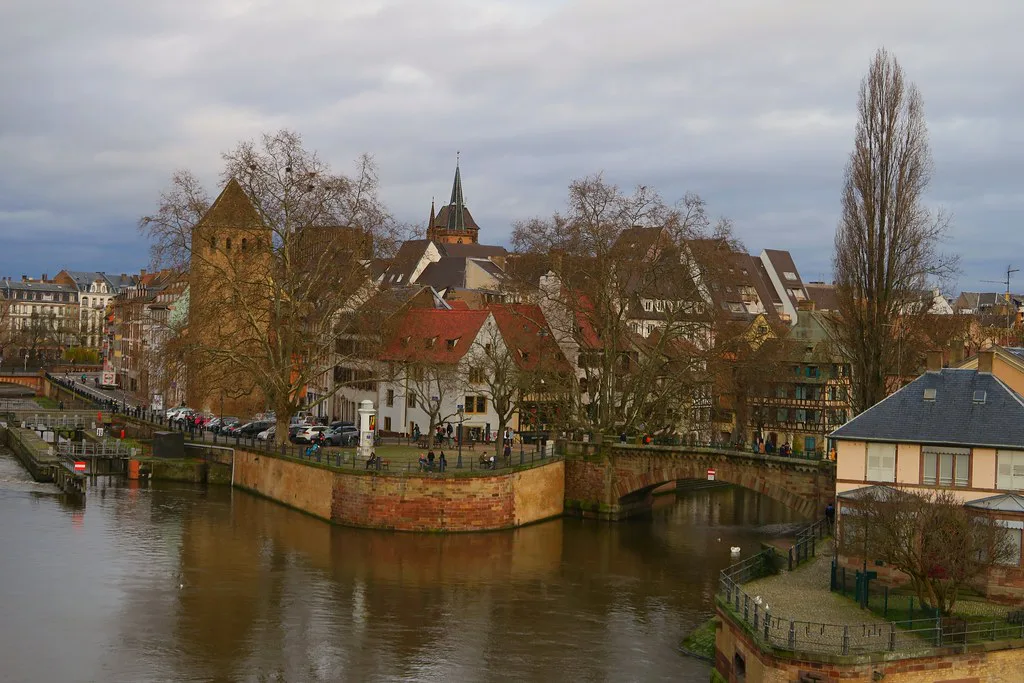
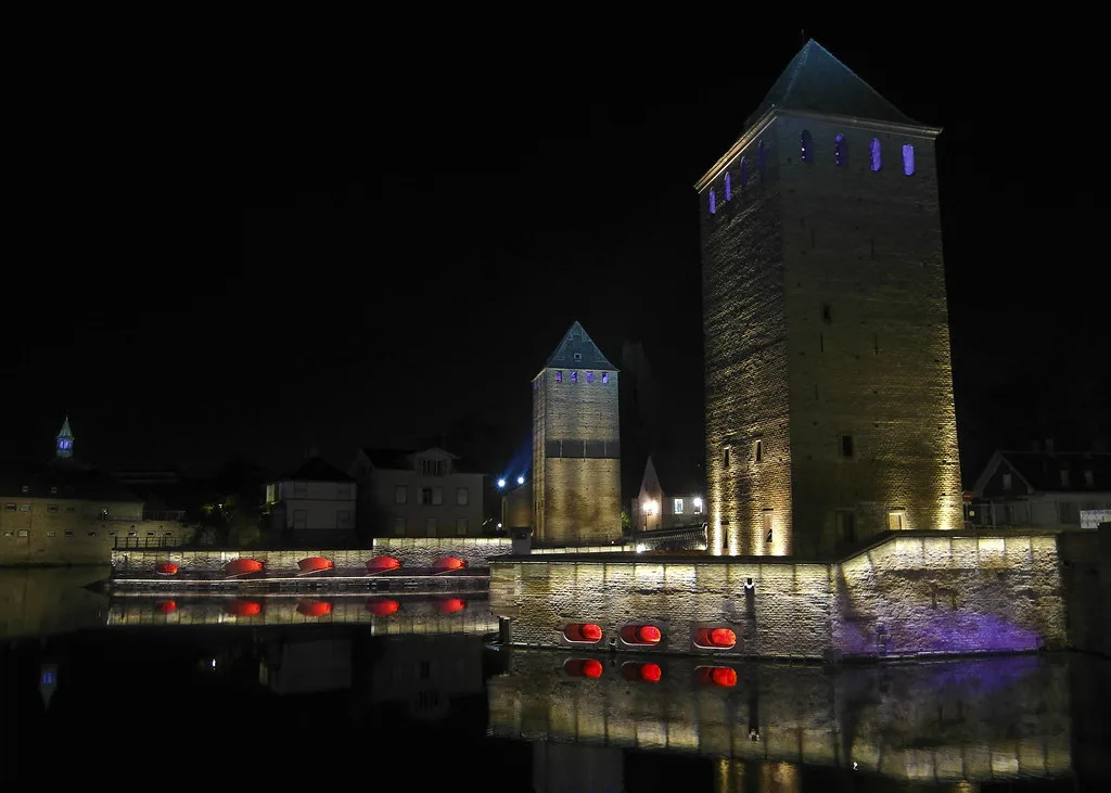
The towers outlived their military purpose and were turned into a prison and place of torture until the middle of the 19th century, which gives the masonry a darker history than the postcard view suggests. One tower was lost in a fire, leaving three standing.
Those three remaining towers were classified as monuments historiques in 1968, the detail that lifts them above scenery into protected heritage. Count three when you stand on the bank.
The classic view from the Barrage Vauban
The photograph most people want is taken from the Barrage Vauban, the covered dam bridge downstream, looking back along the line of towers and spans. Access is free and you simply walk up onto the structure to frame the shot.
Light matters more than equipment here: the towers face you across open water, so early or late in the day softens the contrast between stone and reflection. Budget a few minutes on the dam and then walk across the Ponts Couverts themselves so you see the structure from both sides.
How long to allow and what to combine with it
Plan on 15 to 20 minutes at the bridges and towers, plus whatever time you give the surrounding streets of Petite France. The quarter itself is the real draw, with half-timbered fronts and canal views that reward a slow loop rather than a dash to the viewpoint.
Nearby, the Palais Rohan and the cathedral quarter sit within the same walkable centre, so you can pair the crossing with a museum or a cathedral visit without any transport. Place Kléber works as a central orientation point if you need to get your bearings before heading west.
If you are sketching a wider plan, the area guides set out how the quarters fit together and which parts of the city are worth crossing town for.
Practical points before you go
This is an open-air public crossing rather than a ticketed attraction, so you can walk over it at any hour you would reasonably be out in the city. There are no turnstiles or timed slots to book.
Because it is outdoors and free, the visit costs nothing and works around museum closures rather than competing with them. Check the city's heritage pages for any temporary access restrictions around the towers before a dedicated trip.
Is the Ponts Couverts Worth a Stop?
Yes, if you are already in Petite France: it is a short, free, open-air stop with genuine history behind the postcard. Come for the view from the Barrage Vauban, cross the bridges on foot, and count the three surviving towers.
Skip it as a destination in its own right if your time in Strasbourg is tight and museums are open, since there is nothing to enter and little to do beyond look. Fold it into a walk through the quarter and it earns its place.
Explore more Strasbourg guides
Frequently Asked Questions
Where are the Ponts Couverts in Strasbourg?
They stand in the Petite France district, on the eastern side of Strasbourg's historic centre, spanning the Ill. The simplest approach is on foot from the cathedral quarter, continuing west until the canal and towers come into view.
Are the Ponts Couverts free to visit?
Yes. They form an open-air public crossing rather than a ticketed attraction, so there is no entrance fee and no booking needed to walk over the bridges or view the towers from the bank.
Why are they called covered bridges if there is no roof?
Tile roofs once sheltered the bridges, which gave them the name. The defensive role had ended by the late 18th century, and when the structure was demolished in 1783 to become walkways, the roofs disappeared with it. The stone spans were rebuilt later in the 19th century.
How much time should I allow at the Ponts Couverts?
Around 15 to 20 minutes is enough for the bridges themselves. Most visitors combine them with a walk through Petite France and a look back from the Barrage Vauban, which turns the stop into a half-hour or more of gentle sightseeing.
How many towers are there?
Three towers remain. A fourth was lost in a fire, and the three survivors were classified as monuments historiques in 1968.
What is the best viewpoint for the Ponts Couverts?
The Barrage Vauban downstream gives the classic framing, looking back along the towers and spans across the water. Access is free and you walk up onto the structure; early or late light is easiest for photographs.
Is the Ponts Couverts the same as the Barrage Vauban?
No. The Ponts Couverts are the medieval bridges and towers in Petite France; the Barrage Vauban is a separate covered dam bridge further along the Ill, best known as the viewpoint for the towers.
What else is nearby?
The cathedral quarter, the Palais Rohan and Place Kléber are all within the walkable centre, and the streets of Petite France themselves justify a slow loop. All can be combined with the bridges without using transport.